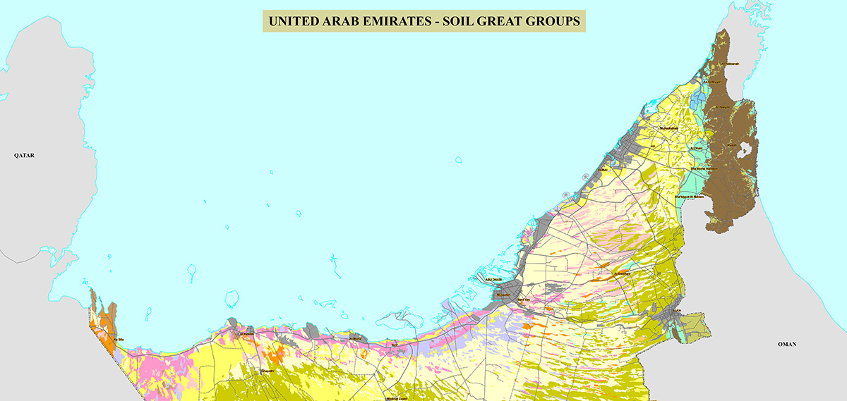
UAE Soil Map
Aquisalids
Calcigypsids
Haplocalcids
Haplocambids
Haplogypsids
Haplosalids
Petrocalcids
Petrogypsids
Torriorthents
UAE Soil Map
This map shows the 10 great groups of soil found in the UAE detailed below. The UAE soils are formed from 2 orders called Aridisols and Entisols. These 2 orders in turn are broken down into 6 suborders, 10 great groups, 41 sub-groups and 74 series found in the UAE.
More maps could be found here.
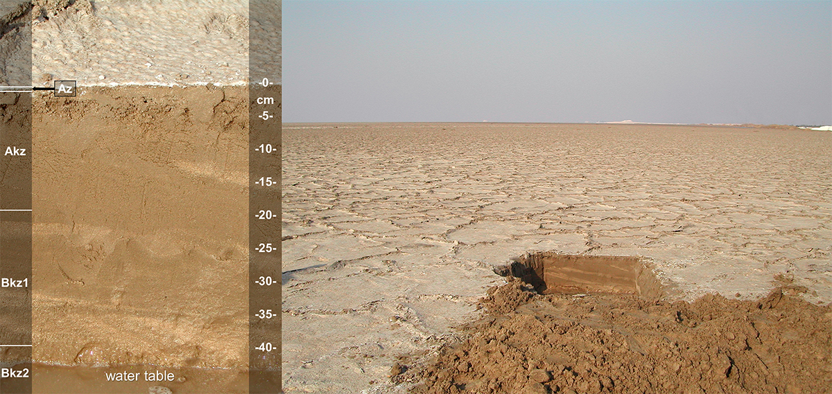
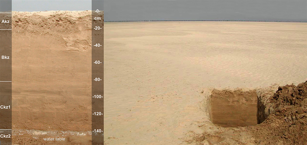
Aquisalids
Aquisalid soils are strongly saline or very strongly saline (salic horizon) soils in coastal and inland salt flats (sabkhas). Despite the presence of groundwater within 1 meter from the soil surface, the high salinity makes these soils physiologically dry. Textures are mostly loamy or sandy. Aquisalids are considered permanently unsuitable for irrigated agriculture due to the near-surface saline groundwater with a high salt content (AD128).
Aquisalids cover 218,186 hectares, or about 3% of the UAE.
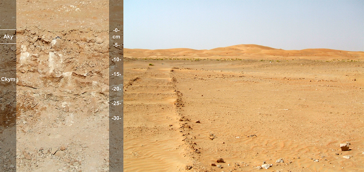
Calcigypsids
Calcigypsids have an accumulation of both calcium carbonate (CaCO3) and equivalents (calcic horizon) and gypsum-CaSO4.2H2O (gypsic horizon) within 1 meter from the soil surface. Most of these soils are sandy and have little suitability for irrigated agriculture due to their high soil gypsum contents (NE023).
Calcigypsids cover 14,181 hectares, or about 0.2% of the UAE.
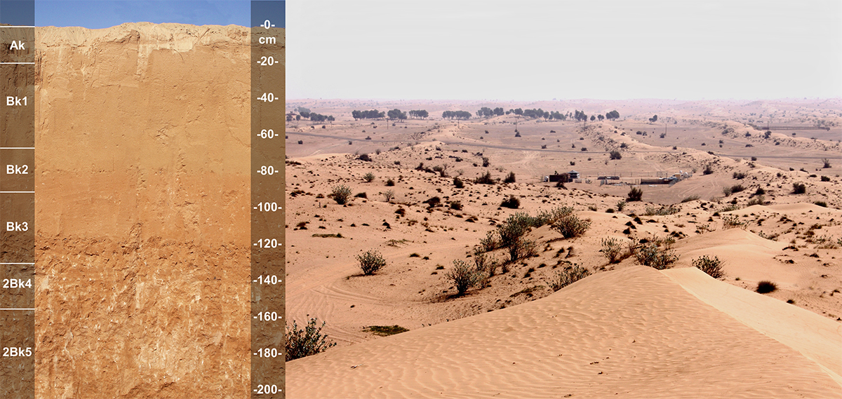
Haplocalcids
Haplocalcids have an accumulation of calcium carbonate (CaCO3) and equivalents within 1 meter from the soil surface (calcic horizon). Textures are sandy or loamy. Haplocalcids have a moderate potential for irrigated agriculture being limited by the sandy nature of the soils (NE017).
Haplocalcids cover 118,861 hectares or about 1.7% of the UAE.
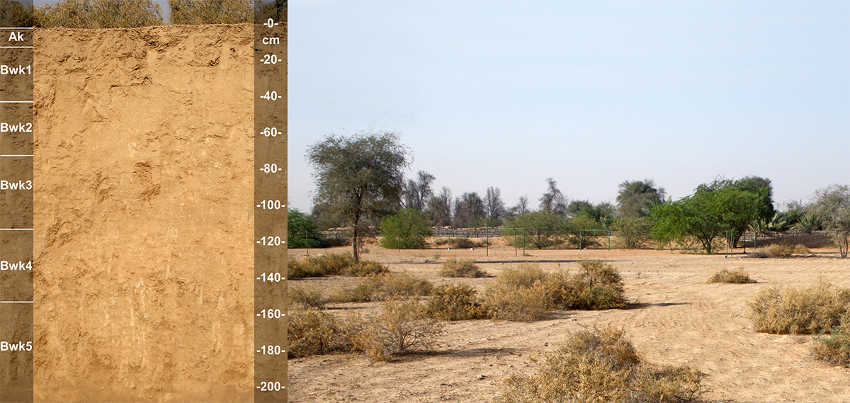
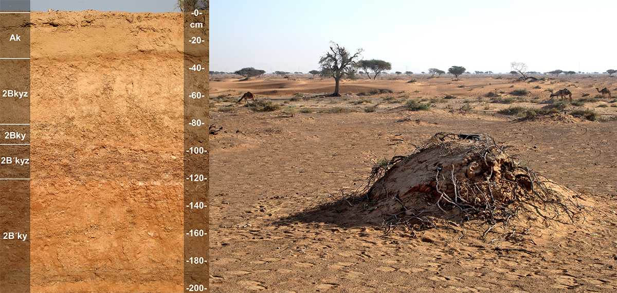
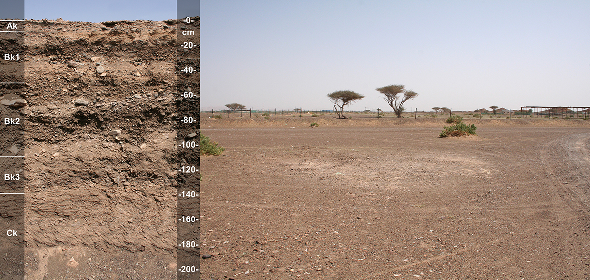
Haplocambids
Haplocambids have a loamy subsoil horizon with a structure and/or color in the form of a cambic horizon. They do not have a sufficient accumulation of calcium carbonate and equivalents (CaCO3) or gypsum (CaSO4.2H2O) to have either a calcic or gypsic horizon. Haplocambids are highly suitable for irrigated agriculture (NE019).
Haplocambids cover 13,803 hectares, or about 0.2% of the UAE.
Haplogypsids
Haplogypsids have an accumulation of gypsum (CaSO4.2H2O) within 1 meter from the soil surface (gypsic horizon). Haplogypsids have sandy textures, but a few are loamy. Haplogysipds have limited suitability for irrigated agriculture due to high gypsum contents and limited soil depth (AD112).
Haplogypsids cover 71,764 hectares, or about 1.0% of the UAE.
Haplosalids
Haplosalids are strongly or very strongly saline. Haplosalids have a concentration of salts within 1 meter of the soil surface (salic horizon). The high salinity makes these soils physiologically dry. Textures are mostly loamy or sandy. Haplosalids are considered permanently unsuitable for irrigated agriculture due the high salt content (AD146).
Haplosalids cover 381,692 hectares, or about 5.4% of the UAE.
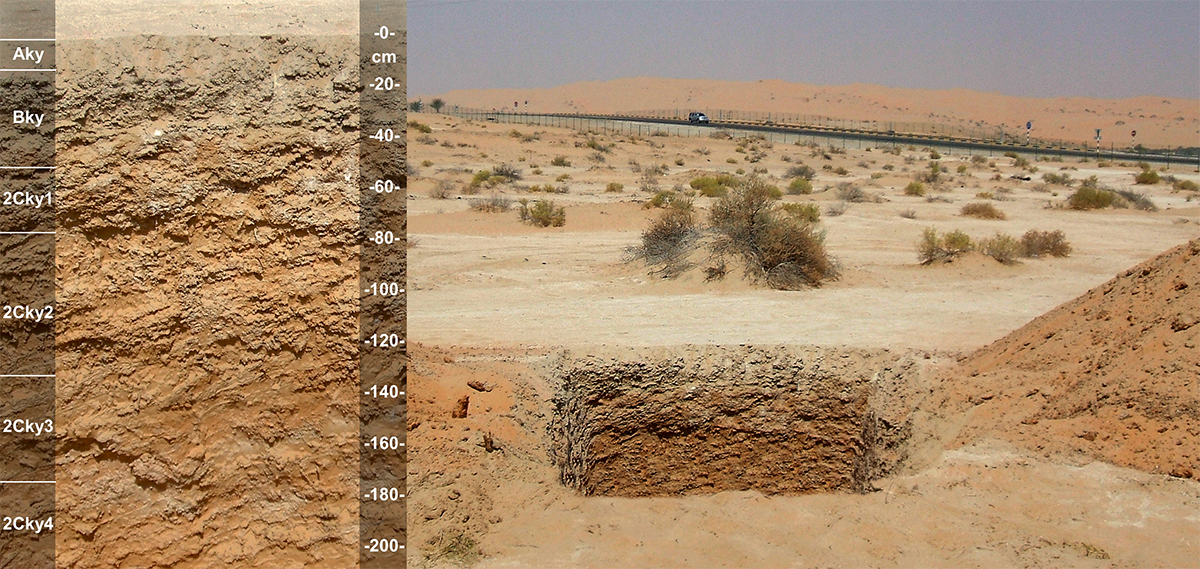
Petrocalcids
Petrocalcids have a subsoil horizon within 1 meter from the soil surface that has accumulated so much calcium carbonate over time that it has become cemented (petrocalcic horizon), forming a hardpan. Most of these soils have a sandy texture. Petrocalcids have limited suitability for irrigated agriculture due to the depth of the hardpan (AD106).
Petrocalcids cover 2,196 hectares, or less than 0.1% of the UAE.
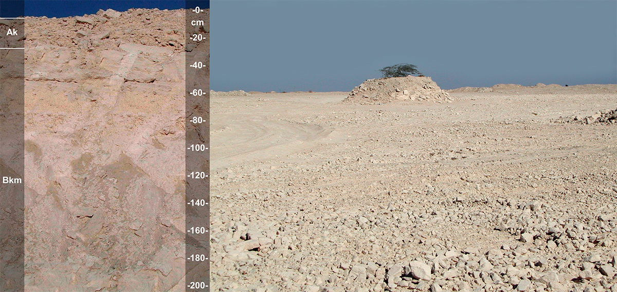
Petrogypsids
Petrogypsids have a subsoil horizon within 1 meter from the soil surface that has accumulated so much gypsum over time that it has become cemented (petrogypsic horizon), forming a hardpan. Most of the Petrogypsids have a sandy, but a few have a loamy texture. Petrogypsids have little potential for irrigated agriculture due to the limited depth of soil to the hardpan and soil gypsum content (AD124).
Petrogypsids cover 263,388 hectares, or about 3.8% of the UAE.
Torriorthents
The Torriorthents have more than 35% by volume, gavels (alluvial fans and plains adjacent to mountains and wadis) throughout the profile. They are mostly sandy and loamy in texture. Torriorthents have limited suitability for irrigated agriculture due to the gravel content of the soils (AD105).
Torriorthents covers 62,123 hectares, or about 0.9% of the UAE.